

Future development may bring City of Guelph’s urban landscape even closer to edge of Puslinch Township
— August 20, 2017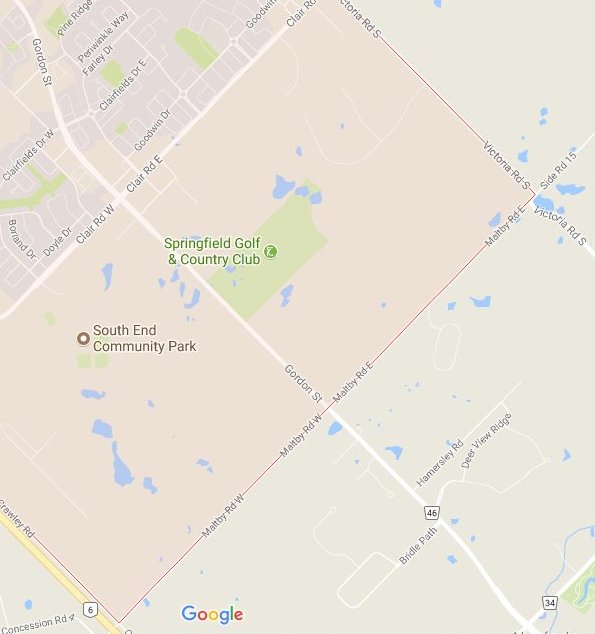 by Mike Robinson.
The next stage of Guelph’s planning may bring the urban landscape even closer to Puslinch residents.
On Aug. 9 City of Guelph staff updated Puslinch councillors with respect to the Clair-Maltby Secondary Plan (CMSP) and Master Environmental Servicing Plan (MESP).
In recent years, a wave of development brought the city landscape just south of the Gordon Street and Clair Road intersection at the southend of the city.
This new study area is looking at potential development in the areas south to Maltby Road and east to Victoria Road.
The Clair-Maltby Secondary Plan Study will help Guelph plan development of the last greenfield area within the city.
The study area is over 520 hectares (roughly 1,300 acres) and is located in the southeast corner of Guelph surrounded by Clair Road to the north, Victoria Road to the east, Maltby Road to the south and the eastern limits of the Southgate Business Park to the west.
[Click here to read the full story…]

via Wellington Advertiser
About author
Related Articles
-
-

Puslinch Residents Voice Concerns Over New Trucking HQ
March 30, 2023 -

Proposed Trucking HQ Draws Ire Of Aberfoyle Residents
March 24, 2023 -

Please Support Local:
Advertisement
Advertisement
