

Latest Update On Jet Fuel Spill
— March 29, 2019The Ministry of Environment, Conservation and Parks has directly provided the following update:
Currently, most of Aberfoyle Creek and Mill Creek are free of ice, but shorelines remain partially frozen. Visual observations and surface water sampling continues. Localized areas of sheen have been observed north of Wellington Road 35.
The surface water sampling results in Aberfoyle Creek and Mill Creek continue to be non-detect and therefore, are not exceeding any referenced surface water guidelines downstream of the spill site at Highway 401 for jet fuel related parameters.
Slight, occasional jet fuel odours are being observed at the culvert north of Highway 401, at Concession 2 road crossing, and at the Private Dam at Grandy Lane.
There continues to be no impacted fish or wildlife observed. Migratory birds (Canada Geese and mallard ducks) are being observed at locations along Mill Creek. Fish observed in the area of Concession 2 to Wellington Road 35 show no signs of visible distress.
Next week the consultant will begin the Shoreline Cleanup Assessment Technique survey in Aberfoyle Creek and Mill Creek. The survey is a systematic method for assessing affected shorelines after an oil spill, and is utilized/recognized worldwide.
The objective of the survey is to complete a full assessment of shoreline conditions to verify shoreline oiling, decide on appropriate response priorities and treatment technologies, evaluate cleanup effectiveness, and conduct final evaluations of shorelines to ensure they meet cleanup endpoints.
At the Highway 401 spill site, soil and water delineation continues. Jet fuel impacted soil continues to be removed and impacted water is being treated on-site. No impacted water is entering Aberfoyle Creek and Mill Creek.
Any questions regarding this update are to be directed to:
Lynette Armour, Provincial Officer at 519.826.4759 or 1.800.265.8658
via puslinch.ca
About author
Related Articles
-
-

Puslinch Council Remuneration Totals $138k
March 21, 2023 -

Puslinch Discontinues Shop Local Gift Certificate Program
March 21, 2023 -

Please Support Local:
Advertisement
Advertisement
Upcoming Events
Mar
25
Sat
10:00 am 2023 Guelph Scouts Craft Fair
2023 Guelph Scouts Craft Fair
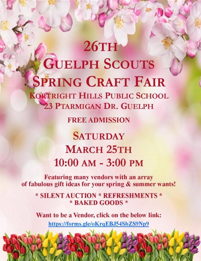
Mar 25 @ 10:00 am – 3:00 pm
The 2023 Guelph Scouts Spring Craft Fair is taking place on March 25th at Kortright Hills Public School. Share this:FacebookTwitter
Mar
31
Fri
5:00 pm Chili Dinner @ Arkell United Church
Chili Dinner @ Arkell United Church

Mar 31 @ 5:00 pm – 7:00 pm
Chili Dinner! Share this:FacebookTwitter
